- Location Derbyshire

Things are taking a little longer than usual, please bear with us...
Two day Introduction to Map and Navigation Skills
Highlights
This 12 hour / 2 day map reading course aims to equip the novice with the navigation and hill skills to safely navigate paths and tracks on UK hills in summer conditions. Based in the Peak District National Park, this course is for those of you looking at getting started in the outdoors, or those just wanting to start again from a clean slate. We will look into all of the basics of map reading including some basic uses of the compass as you start your journey to master the art of navigation. .
A great introduction to the navigation skills you need to get out and about.
Topics we will cover include:
Equipment for the outdoors Understanding map symbols and scales, on a variety of maps 6 figure grid references Orientating the map with and without a compass Identify land features and indicate direction of travel Choose simple navigation strategies and routes Use linear features (e.g. paths and tracks) as handrails in simple navigation exercises Estimate distance on both map and ground Using a basic understanding of contours, match major landforms like hills and valleys to their map representation Planning a safe, suitable walk Relocating using simple techniques on paths and other handrails Awareness of local and national access issues and access legislation Countryside Code and procedures to be followed in the event of an emergencyDay 1We’ll meet up and head immediately into the café. Here we’ll talk about the day ahead and have a look at the map and at the day’s route. After talking about kit for the hill we’ll head out for the day and practice those navigation skills.Day 2We'll spend the day out on the hill again, finishing by 4pm
Inclusions
What's Included
🧰 Equipment - Maps and compasses provided
What you'll need
🧤 Warm Clothing
☂️ Waterproofs
🍴 Food - Please bring a packed lunch and snack for a day on the hill
🥤 Drink - 1-2L of water, depending on the weather
Make this experience your own: Contact us
Cancellations
Custom Policy
- Cancel before 31 days of your adventure and receive a 75% refund (minus payment processing fees).
- Cancel within 30 days of the adventure with no refund.
- Alternate dates may be able to be agreed at no additional cost, but this is not guaranteed.
Location
Derbyshire
Provider
Will4Adventure
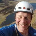
Will4Adventure was founded by and is run by, William Legon. Qualified mountain leader, rock climbing instructor, first aid trainer, well tra...